
Mt Rainier’s East Side from Sunrise to Box Canyon contains some of the most memorable scenery along the Wonderland Trail, for both day trips and those looking to complete the entire circuit around the Mt Rainier. The two backcountry campgrounds – Summerland and Indian Bar – are among the most desirable in the National Park, and thus hardest to secure, but for good reason. Both are within a day’s hike from a trailhead, making them suitable for weekend trips and short overnights as well for completing the East Side of the Wonderland Trail.
Thanks to an early access lottery win, we were able to secure permits for both Indian Bar and Summerland on our counterclockwise thru-hike of the Wonderland Trail in August 2024. This trip report is the fifth, and final, trip report from our 12-day adventure.
Read our Wonderland Trail backpacking trip reports from the beginning, starting from White River.


Table of Contents
Wonderland Trail Day 10: Box Canyon to Indian Bar
I paused after crossing the road from the out-of-service Box Canyon comfort station, contemplating the need to backtrack down to the road and pick up the trail from where we’d initially crossed. There was a very prominent “Wonderland Trail” sign on the west end of the parking lot pointing directly up the hill, but I thought we’d taken a short cut to the road after crossing over the tunnel, which meant we must have bypassed some portion of the trail.

The rest of my party didn’t much care whether or not we’d taken every step of the Wonderland Trail proper, but I figured there must be something here beyond the parking lot beyond the view from the road to put Box Canyon on the map. I backtracked the forty yards or so to reconnect with the split in the trail, and there was in fact an overlook and decent view of the Mt Rainier from the Box Canyon Loop trail which connected the dots in a slightly more scenic way than walking down the sidewalk on Box Canyon road, even if it did take an additional five minutes.
Today would be the big upward push up the Cowlitz Divide, with a steady 3000 ft gain over the first 6 miles and we knew from experience we’d need to take it in stages. Last time we’d hike this segment was on the second day of our first Wonderland hike in 2021. Our pacing was off; we pushed too hard and burnt our energy too quickly, our muscles fatigued, blood sugar dropped, and we ambled into Indian Bar near dusk into the least desirable site in the campground sore and miserable. We were not going to repeat the mistakes of the past.
We reconvened at Nickel Creek, had a quick snack as we refilled our water containers and then steeled ourselves from the switchbacks up to the ridge line.


Whether it was increased stamina or the handful of Jelly Bellys I kept in my side pouch, we hiked through the woods with relative ease, stopping a few times for a quick breather before continuing onto the next of switchback. I didn’t count how many there were, but no matter how many times you think you’re at the top, there seemed to always be at least one more.
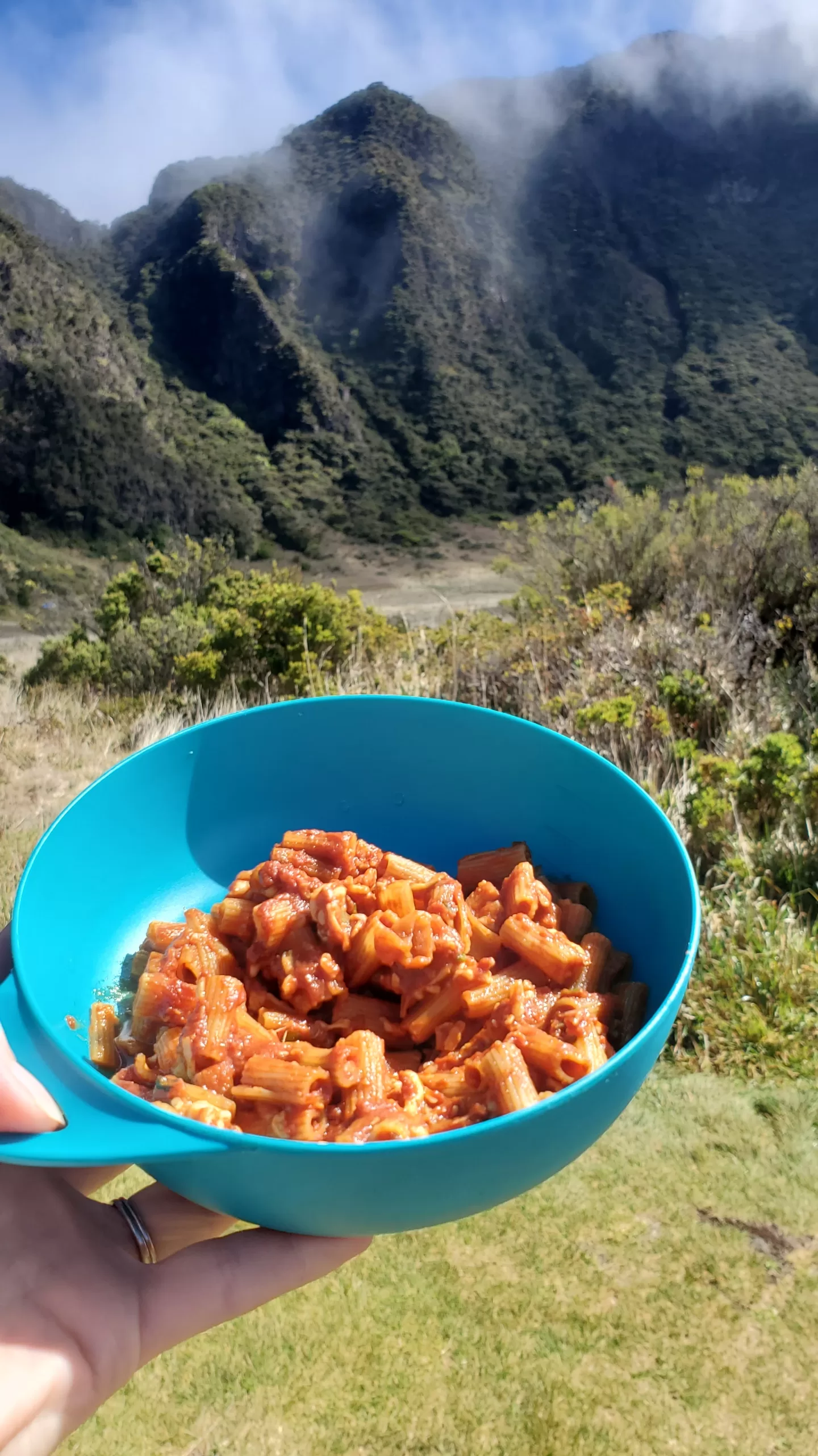
We stopped for lunch (our cold soak chicken salad with crackers) after finishing the last switchback, just short of the turnoff to Ollalie Creek Camp on the Cowlitz-Divide Trail (not to let the name fool you, that trail is simply an alternative route to the Cowlitz-Divide. It’s the Wonderland Trail that actually traverses it). We’d made good time but I was uneasy with the amount of water we had left, knowing there would not be another water source until camp. It was easy to think of completing the switchbacks and reaching the ridge as the ‘end’ but really it’s just the start of a second push.

The next section was the steepest of the entire Wonderland – a short, nearly vertical section of dirt trail. Inching down in the opposite direction was a women with an ankle injury who was painfully evacuating to the Box Canyon trailhead assisted by her friend. We offered to use our Garmin to get in touch with the rangers for assistance but she declined. We made sure she had enough anti-inflammatories and let them know that the man hiking the Wonderland behind us was a nurse. Getting to know who else in the trail around you comes in handy sometimes!


Five minutes later, we met the couple from Michigan whom we had spoken with at Golden Lakes. They’d left their trekking poles at home as they didn’t want to check them on the plane, but they each now carried a large stick – a literal walking stick as it were – that they’d found in the five days since we’d seen them last. The elevation gain and loss on this trail is no joke!
The weather was as good was we could ask for as we climbed along the backbone of the Cowlitz Divide; a bit hazy but relatively clear with a gentle breeze. The asters were in full bloom, along with tall, luminous spikes of bear grass (Xerophyllum tenax) and lupine. The trail undulated along the ridgeline for almost two miles before we finally crested the ridge and could look down towards Indian Bar.


It was still early in the day, not even 2pm. We felt jubilant – and proud of ourselves – for hiking this section with such relative ease. Clouds were starting to form around the summit, but there was still a clear view all the way down towards the Ohanapecosh River.


Andras went down ahead to try and get Site 2, unquestionably one of the most coveted spots on the Wonderland. My dad and I knew our knees couldn’t handle the decent at a faster clip (and unfortunately, we would later come to learn that Andras’s couldn’t either) so took the descent at our own slower pace.


To our great pleasure, we arrived at Indian Bar Campground to find Andras successful! Campsite #2 has private views into the river basin and – were it not for the clouds starting to roll in – of Little Tahoma. It also had a little resident gopher who poked his nose out to see what we were up to before quickly ducking back into his hole.
We spent the afternoon soaking our feet again down in the icy glacial waters of the Ohanapecosh River and lounging around camp, celebrating the good fortune of the campsite, the great timing we’d made, the long hours we had to explore the nooks of crannies of Indian Bar – everything we couldn’t do last time.


Dinner was one of our classics, homemade backpackers lasagna. And then we packed everything down for the night. The clouds rolling in suggested that wetter weather could be on the way but we we were still hoping that we’d manage to shoot the gap between the weather system in place right before we started and one imminently looking to arrive.
Wonderland Trail Day 11: Indian Bar to Summerland
We woke up to the sight of water droplets splattered atop the outside of the rain-fly. I didn’t recall the sound of rain, but the source became apparent once we opened the tent flap and looked out. We were sitting in the midst of a thick, white cloud that had settled into the valley overnight.


With less than five miles to our next campsite at Summerland, there wasn’t any particular rush to depart camp, but the mood was a mixture of hope that we’d be able to hike above the cloud layer and into better weather up above and a resignation to just ‘get this over with’.
We had encountered precisely the same weather between these two camps in 2021 and the long, steep climb through the frigid expanse of white. Lacking any visibility and any sense of where we were, the monotonous grind felt like it would never end and ranks upon one our of worst days on trail. We had since re-hiked that section in glorious fall weather so now we’d be able to orient ourselves to our relative location along the trail.


We layered up in our rain gear and hit the trail. In some way, it was a bit of vindication for having carried it all the way around the mountain. I took the lead so that the GoreTex of my rain pants could knock off as much water as possible from the shrubbery along the trail (after stopping to look at some tadpoles – probably of the Cascades frog – we found swimming in the shallow pools near the stream).


Within the first half mile from camp we were told by some clockwise hikers that the weather was clear at the top of the ridge. They’d described having an ideal morning – they’d even seen a herd of mountain goats – and reported that they’d only entered the clouds in the last 10 minutes or so. It boosted our spirits with the knowledge that hiking out of the cloud was a distinct possibility within the next half hour or so, accounting for their pace coming down compared to our pace hiking up.


The air was still dense with moisture as we hiked through the blueberry switchbacks and then into the flower fields still shrouded in mist. The lavender blossoms of the asters blanketed the hillside, and from a distance, the foliage occluded the trail, making it appear as though we were walking straight through a wildflower meadow.
We rested at the edge of the meadow in a grove of trees that we knew from experience had a a good log bench for sitting. On warmer days, this grove offers a nice spot of shade, but today it provided a relatively dry area to strip off some layers before hiking along the ridge.

Despite the descriptions of blue skies from the hikers earlier, the ridge line looked exactly as it had three years ago. This time, though, we could at least imagine the views to either side of the trail. At this point we realized that the clouds were likely rising along with us – as we hiked higher, the clouds were also rose and were following us all the way to the top.
Finally, only a few hundred yards from the top, the promised blue sky began to materialize, first as the visibility began to improve . . .

. . . and then finally, as we crested the ridge, we emerged fully from the clouds!

From here, the trail stays high as it skirts above Ohanapecosh Park en route to Panhandle Gap.


Apart from a few small streams trickling down into the valley below, the area has a moonscape quality. It’s rocky, but not barren if you look closely enough. Low growing saxifrages and moss campion are the most distinctive, but there are also grasses, heather and other subalpine flowers in the wetter areas. We didn’t really need to stop for water, but the setting was so beautiful we stopped anyway


At Panhandle Gap for lunch, we stopped to eat the last of our rehydrated peanut butter powder and crackers as watched the clouds blow up and over the pass. The high point on the Wonderland Trail! Any lingering hopes that they would burn off were extinguished, not that it mattered. The skies were clear on the far side of the pass and looked to be clear as far north as we could see.
We were 90% of the way around the mountain with only 4 miles affected by sub-optimal weather, and even then, we’d managed to avoid any actual precipitation.


For only the second time we encountered patches of snow on the trail, the first being on the other side of the mountain hiking over Spray Park. We knew this area is one of the last sections to melt out so had intentionally put it towards the end of the trip.
The scenery hiking down from Panhandle Gap towards Fryingpan Creek with the turquoise alpine lake is some of my absolute favorite. I hung back to take some pictures, both with and the without the wisps of clouds that were still tumbling over the pass. While waiting for me to regroup, Andras shifts his weight and hears his knee pop while standing at one of the water crossings. We didn’t know it at the time, but he’d torn his meniscus and would have to be scheduled for surgery. For now, though, it did seem concerning but not acute.


A log bridge was in at upper Fryingpan Creek, so one of the more treacherous river crossings was entirely uneventful. I’ve made this crossing before when the bridge out and it can be pretty harrowing depending on how high the water is, especially knowing how quickly it would sweep you straight off the mountain. This was the last uncertainty of the trip – it was all downhill from here!
As we entered the blooming meadows of Summerland it felt very appropriately named in that moment. Looking back towards the bank of clouds as we basked in the afternoon sun, for the first time all day it did, indeed, feel like August.


We established camp in Site 5, a large site towards the rear of the campground with a partial view of the summit. A handful of other campers had already arrived before us, including a group we’d met earlier on the west side. Our last night in camp and after eleven days the chores had become routine. Tents were set up and chairs were unfolded.
A yellow-rumbled Audubon’s warbler flittered about in a fir tree above the campsite. A marmot feasted on lupine blossoms. Last time we were here we saw a rare wolverine and this time we heard that there was a critically endangered Cascade Red Fox that had been spotted around Summerland. This was the life.

The break in the clouds didn’t last long, and the skies began to cloud over. Just wisps at first, before the familiar mist began to settle. We cooked up the last of our homemade backpackers coconut chicken & rice and tucked into the tents early. Suddenly we heard a startlingly loud clap, clap, clap.
The ranger who had come to check permits had spotted the fox and was chasing it away. Much like the bears in Yosemite, if the fox learns to associate humans with food by hanging around the campgrounds, it puts them at greater risk of car strikes as they encroach into more populated areas or developing nuisance behavior.
We settled back into the tents for the night, when Andras heard the fox sniffing around the tent. I immediately jumped out to see undeniable paw prints visible in the damp dirt around the tent. I followed the tracks away from camp until they disappeared. So close, but we’d missed him for the second time. Just as I was about the re-enter the campsite I noticed some movement off to my left – there he was!


In all my excitement, I didn’t notice that the exposure knob on my camera had gotten knocked down a few clicks as I watched him playfully frolic in the meadow and then bound away. Only later did I realize what had happened – but what an experience! Our last night on the Wonderland and the trail was still delivering new thrills.
Wonderland Trail Day 12: Summerland to White River
It was a bittersweet morning as we stepped out of the tent to drink our tea/coffee under patchy blue skies. Less than 7 gentle miles stood between us the completion of the Wonderland Trail! Today would be the day that we finished the trail and traded our now familiar rhythms of the trail for the routines of ordinary life.

It was shockingly cold out compared to other mornings and I found myself bundling up in numerous layers to stay warm – a thin blue woolen baselayer, a blue Patagonia micro-fleece, a cerulean blue layer of down, and then my lagoon blue Houdini jacket for wind protection. Four layers of blue! Perfect to match the blue gentian that was blooming in the meadows!


I took the camera out into the meadow to photograph the mountain, which was completely unobstructed for the first time in several days.


It was a good thing I took photos when I did, because the clouds had already started rolling in. You could look down into the lowlands and see the inversion of clouds below.


We broke camp one final time and headed out, with the mountain intermittently peaking through the clouds as we descended the switchbacks.


Just before reaching the lower Fryingpan Creek we traversed a meadow awash with purple and magenta blooms. There were stands of Cascade aster, distinguishable from alpine aster based on whether there is a single flower or multiple on a given stem, and brightly colored fireweed rising above. Even on the last day we are still receiving the full wildflower treatment from the mountain!


On the way down we continued to pass large groups of day hikers on the way up, including numerous individuals with colorful beads and birthday attire strung along the trail over a half a mile or so. We finally passed the birthday girl – 80 years young and celebrating her continued ability to get out on the trail. I hope we have just as many decades of hiking ahead of us.


Once we entered the forest it felt like the home stretch, even though there was still about four miles left to go. The trails were now wide and gentle, so we had to consciously rein ourselves back and remind ourselves to enjoy the last few miles, rather than sprint to the finish. Once we split off from the Summerland Trail back towards White River, we listened for the distinctive roar of the river and followed the sound all the way back to the trailhead.
Walking across the log bridge over the White River was our equivalent of crossing the finish line – we’d done it! The full 93 mile circuit around Mt Rainier with over 23,000 ft cumulative elevation gain and loss.

Mount Rainier Wonderland Trail Thru-Hike Round-Up
I had very high hopes for this trip after receiving such a lucky draw in the lottery – the first slot on the third day of early access, placing me at number 60 in line ahead of thousands of hopeful hikers. I got our dream itinerary, during peak season and with twelve days of mostly clear, rain-free weather. We got at least one clear glimpse of the mountain every single day on the trail for nearly two weeks. Even if I’ve ended up using up my entire cache of good fortune on this one backpacking trip, it was worth it.
Highlights
- Wildflowers everywhere. The last week of July and first week of August are typically some of the best weeks for wildflowers depending on location. The blooms were particularly stunning at Sunrise, the climb up to Spray Park, between Klapatche Park and St Andrews and on the Cowlitz Divide.
- Alpenglow from Klapatche Park. Perhaps made more special over all the failed attempts over the years, we had a near perfect reflection of Rainier in the waters of Aurora Lake as the sunset cast a reddish glow on the glacier covered summit.
- Camping at Indian Bar. Indian Bar is a hard campground to secure a reservation for to begin with, and on top of that you have to be the first hikers to arrive at camp in order to get the site with the best view. Spending the afternoon at Site 2 felt like winning the Wonderland Lottery all over again.
Lowlights
- The solar toilet ‘situation’ at Cataract Valley. The less spoken about this the better, honestly.
- The biting flies and mosquitoes near Devil’s Dream. DEET helped a little, but it forced us to rush through several areas of just to keep from getting swarmed.
- Losing the trail at the Kautz Creek crossing. Footprints indicated that we weren’t the first to get off trail in this section, but the trail no longer crosses the boulder field. We should have gone back to see if we could spot a pink or orange ribbon tied to a tree.
- Sinus headaches and illnesses. What we thought might have been allergies to the wildfire smoke developed into full-blown sinus cold for two of our party. While everyone rallied and pushed through to recovery, this almost forced us to cut the trip short.
What We’d Do Differently
- Honestly, very little. We had this trip pretty much dialed-in in terms of itinerary, gear and food. We arrived into camp each day with plenty of time to relax, explore and otherwise bask in the experience. Our meals kept us satiated and we didn’t hike out with a lot of extra food weight. But we did learn to pack extra cold/sinus medication for higher altitude hikes as well as pack extra large heel bandages because the options at the gift shop were unreliable.
Read our Wonderland Trail backpacking trip reports from the beginning as we circumnavigate Mount Rainier!
- Days 1 – 3: The North Side: White River to Cataract Valley
- Day 4: Spray Park Alternative: Cataract Valley to Mowich Lake
- Days 4 – 7: The West Side: Mowich Lake to Devil’s Dream
- Days 8 – 10: The South Side: Longmire to Box Canyon
- Days 10 – 12: The East Side: Summerland, Indian Bar and Completion – that’s this trip report!
Planning your own trip along Mt Rainier’s Wonderland Trail? Check out our Guide to Backpacking the Wonderland Trail
Have you hiked this section of the Wonderland Trail or are you planning to backpack the Wonderland Trail in Mount Rainier National Park? Share your experience or let us know what questions you have in the comments!